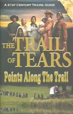
 Points Along The Trail
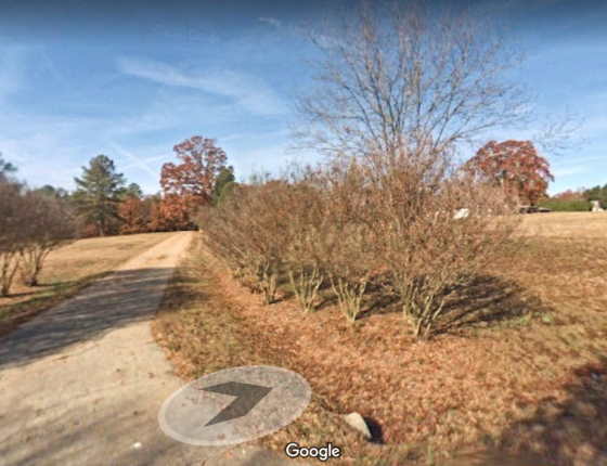
Camp Means
Day One on the Trail of Tears.
We started by visiting the site of the Camp Means Internment Camp. It was named for Captain John S. Means, first commander of the post. It was located southwest of Kingston, GA and about ten miles from our home at the intersection of Reynolds Bend Rd SE and Branson Road SE. This is just across the way from the church known for their rattlesnake handling which I discusssed in "Kingston Then and Now." Four hundred and sixty seven Cherokee were housed there for a few weeks before being driven to Ross Landing (Chattanooga). There is now nothing but an open field.
"[I] witnessed the execution of the most brutal order in the history of American warfare. I saw the helpless Cherokees arrested and dragged from their homes, and driven at the bayonet point into the stockades. And in the chill of a drizzling rain on an October morning I saw them loaded like cattle or sheep into six hundred and forty-five wagons and headed for the West." - Pvt. John G. Burnett, 1838.
Due to the poor sanitation of the internment camps, deadly diseases such as whooping cough, measles and dysentery spread among the Cherokee.
Reverend Daniel Butrick, a missionary who had ministered in the Cherokee territory for 20 years, wrote:
“from their first arrest they were obliged to live very much like brute animals, and during their travels, were obliged at night to lie down on the naked ground, in the open air, exposed to wind and rain, and herd together, men women and children, like droves of hogs, and in this way, many are hastening to a premature grave.”
History of Fort Means
This Internmennt Camp was established in May 1838 as a Cherokee removal fort by Captain John S. Means and one mounted company. In June, 467 Cherokee prisoners were moved from Fort Means to Ross’s Landing.
The first of two military stations in Floyd County was established in April 1838 in response to a local suggestion. Replying to Governor Gilmer's February inquiries, the Cherokee Nation's former attorney, Judge William H. Underwood, reported that he saw "no appearances or an intention on the part of the Indians to commence hostilities." Nonetheless, the judge thought it wise "to keep up a show of force" to intimidate the Cherokees. He advised Gilmer to "station one company on the line between Floyd and Cass Counties near General Miller on the Etowah River," a location not far from Underwood's home. In early March, Gilmer ordered into service Captain John S. Means of Walton County, who received instructions to "take post in Floyd County near the dividing line between it and Cass County, and also near the Hightower [Etowah] River." Soon after, Means mustered in at New Echota with a company of sixty-five privates, three officers, and four servants (likely slaves), then advanced to a site on the Etowah River as Underwood had suggested. By April 15, soldiers were at work constructing a fort one mile east of General Andrew Miller's between the Etowah River and the nearly parallel Etowah road. Cherokees and Georgians lived nearby, scattered along the river and its tributaries.
Over the next month, company privates earned fifteen cents a day in extra-duty pay felling trees, clearing brush, digging trenches, making and installing pickets, and building store houses, a block house, stables, and a hospital. Almost all their tools—axes, ropes, chains, mattocks, shovels, hatchets, hammers, nails, files, and more—came by wagon over pitted roads from Tennessee headquarters eighty-eight miles away. In addition to the transport of construction materials, wagons creaked and groaned to the fort loaded with 200-pound barrels packed with thousands of pounds of bacon, salt, coffee, beans, soap, vinegar, candles, and flour. The supplies could hardly keep pace with the fort's increasing population. Dr. Eldridge W. Allen of Franklin County, who had just completed medical training, arrived to serve as post physician and on May 24, Captain Frederick W. Cook marched in with his Oglethorpe County infantry company, increasing the number of soldiers to 155 men. With removal just two days away, the privates in Means's company must have been relieved to see Cook's troops. They needed help finishing the blockhouse and the fort's entry gate.
Post quartermaster William Graham worked with Floyd County citizens as he built, supplied, and sustained the fort. To make flooring, he purchased thousands of feet of plank from John Johnston, one of the men who evicted Quatie Ross in 1835.73 From his home a mile from the post, John Miller sold Graham hardware for doors and gates and writing materials for keeping quartermaster records. Andrew Miller supplied oxen to haul logs and install the palisade walls. William T. Price, who owned two nearby lots, and Joseph Watters some ten miles away were among those selling thousands of bushels of corn and bundles of fodder for company horses as well as the horses, mules, and oxen that pulled wagons. Price crossed the Etowah River more than sixty times ferrying soldiers, horses, baggage, and wagons. Wilson R. Young allocated a room in his house for a sick soldier and Henry Frick sold the quartermaster a table and a desk, almost the only furniture in the simple fort. The names of numerous other Floyd County residents—James Hilton, Benjamin Penn, Stephenson Johnston, Benjamin Dykes, Samuel Morgan, Ezekial Graham, Nathanial Burge, and Zachariah Aycock—entered military records as citizens who made removal from Fort Means possible. Profiting financially from the expulsion of Cherokees, Floyd County citizens sanctioned Georgia's policies.
A few days before the treaty deadline, post commanders estimated the number of Cherokees in a fifteen-mile radius of their position. Noting that he saw "no sign of hostility," Captain Means presented his survey on May 22 in terms that illuminate the reversal of Cherokee life in less than a decade. Rather than identifying Cherokees by name or even age and sex, he simply provided the total number of people for each cabin he saw. Additionally, he listed Cherokees as occupants of land belonging to white citizens rather than the reverse. Beginning with eight cabins and fifty unnamed Cherokees on "Mr. Putnam's plantation," Means noted thirty in four cabins on Mr. Williams's property and twelve in two cabins at Mr. Mann's. Crisscrossing the Etowah River, he reckoned Natives on the land of Fagin, Price, Lampkin, Wooly, Burgess, and Judge Underwood. He estimated those along the Oostanaula River on Joseph Watters's property and at George Lavender's. The landowners, "who are acquainted with them," assisted Means in his enumeration of the frightened obdurate Cherokees. More than a military accounting, the survey provides a symbol of removal from Georgia. It consigned the land where Cherokees lived to the Georgians who acquired it and, in the process, erased Cherokee identity.
While Means prepared his fort and men, plans emerged for an additional post near Rome. Assuming the likelihood of "some very unpleasant occurrences," James Gamble had advised the governor to station soldiers in the Chattooga Valley "near the dividing line between Walker and Floyd [counties]." Thomas G. McFarland echoed Gamble's suggestion, adding that there was "a considerable number of Cherokees in that neighborhood and some of them very vicious." Nothing developed until the second week of May when hundreds of men mustered into federal service at New Echota and learned their assignments. Captain Stephen Malone, arriving with his "servant" Arram and a drafted company from Henry County, was promoted to colonel and ordered to set up the post that became known as Camp Malone. It seems probable he selected a site north of Rome and perhaps in the area recommended by Gamble and McFarland.
This post was abandoned about 30 Jun 1838.
Sources:http://www.fortwiki.com/Fort_Means
https://southernspaces.org/2017/all-roads-led
-rome-facing-history-cherokee-expulsion/
Captain Lewis complained to Governor Gilmer about the requirement to muster every week: Lewis to Gilmer, March 26, 1838, in Hays, comp., GMA, Vol. 9, 84.
67. Hill, "Cherokee Removal Scenes," Southern Spaces. Contrary to state and federal policy, Captain Samuel Farris of Walker County commanded the companies in his own county; as removal began, Captain H. I. Dodson commanded a Tennessee company at Fort Hetzel in Ellijay. Farris's work is examined in Stephen Neal Dennis, A Proud Little Town: LaFayette, Georgia 1835–1885 (LaFayette, GA: Walker County Governing Authority, 2011).
68. George R. Gilmer to James Gamble, Thomas McFarland, William Smith, James Hemphill, William H Underwood, and others, Feb. 13, 1838, RG 1-1-1, Governor's Letter Books, M240, Reel 35, frames 129–31, GA; William H. Underwood to George R Gilmer, Feb. 28, 1838, in Hays, comp., Cherokee Letters, 672–73.
69. George R. Gilmer to William Lindsay, March 14, 1838, RG 1-1-1, Series 1, Governor's Letter Books, Box 13, 197, GAs; James Mackay to A. R. Hetzel, April 2, 1838, RG 92, Entry 357, Misc. Corr., Box 6, National Archives.
70. John H. Means to George R. Gilmer, April 15, 1838, Hays, comp., GMA, Vol. 9, 94. The fort site has been identified by the Georgia chapter of the National Trail of Tears Association through the meticulous work of former chapter president Jeff Bishop.
71. See, for example, A. R. Hetzel to A. Cox, April 4, 1838, RG 350, Box 2, Vol. 2, National Archives; Hill, "Cherokee Removal Scenes," Southern Spaces.
72. Allen graduated from Transylvania University in 1837–38: Medical Thesis on "Acute Rheumatism," libguides.transy.edu/content.php?pid=522103&sid=4295169; RG 92, Entry 9, M745, Reel 13, Vol. 18, 254 and Vol. 26, 377, National Archives; RG 393, M 1475, Reel 1, frames 0319–22, National Archives and Records Administration (hereafter NARA).
73. Shropshire to Editor, Aycock, All Roads, 45–6.
74. A. Cox Settled Account 4849, Box 1218, Entry 712, Abstract A, Sub Abstract 9, Subvouchers 1–15, and Voucher 143, Subvoucher 13; A. R. Hetzel Settled Account 6814, Box 1263, Vouchers 39 (April 16, 1838), 61 (April 21, 1838), 68 (April 25, 1838), and 6 (May 28, 1838), both Settled Accounts in Records of the Accounting Office, Treasury Department, Third Auditors Settled Accounts and Claims, March 10, 1836–April 21, 1845, National Archives.
75. John S. Means to William Lindsay, May 22, 1838, RG 393, M1475, Reel 1, frames 0819–22, NARA.
76. Gamble and McFarland were among the men Gilmer consulted about the number of companies and their placement. James Gamble to George R. Gilmer, March 16, 1838, "Cherokee Removal Letters," www.rootsweb.ancestry.com/~gachatto/corr/cherokee.htm; Thomas G. MacFarland to George R. Gilmer, April 2, 1838, in Edward Cashin, ed., A Wilderness Still the Cradle of Nature: Frontier Georgia (Savannah, GA: Beehive Press, 1994), 232.
77. Compiled Service Records, RG 94, Entry 57, Box 210, (Stephen Malone), National Archives.
78. The northern site may also have been Georgia's 15th proposed post planned for Dade County "near Perkins" but never fully manned or utilized.
https://southernspaces.org/2017/all-roads-led
-rome-facing-history-cherokee-expulsion/
Captain Lewis complained to Governor Gilmer about the requirement to muster every week: Lewis to Gilmer, March 26, 1838, in Hays, comp., GMA, Vol. 9, 84.
67. Hill, "Cherokee Removal Scenes," Southern Spaces. Contrary to state and federal policy, Captain Samuel Farris of Walker County commanded the companies in his own county; as removal began, Captain H. I. Dodson commanded a Tennessee company at Fort Hetzel in Ellijay. Farris's work is examined in Stephen Neal Dennis, A Proud Little Town: LaFayette, Georgia 1835–1885 (LaFayette, GA: Walker County Governing Authority, 2011).
68. George R. Gilmer to James Gamble, Thomas McFarland, William Smith, James Hemphill, William H Underwood, and others, Feb. 13, 1838, RG 1-1-1, Governor's Letter Books, M240, Reel 35, frames 129–31, GA; William H. Underwood to George R Gilmer, Feb. 28, 1838, in Hays, comp., Cherokee Letters, 672–73.
69. George R. Gilmer to William Lindsay, March 14, 1838, RG 1-1-1, Series 1, Governor's Letter Books, Box 13, 197, GAs; James Mackay to A. R. Hetzel, April 2, 1838, RG 92, Entry 357, Misc. Corr., Box 6, National Archives.
70. John H. Means to George R. Gilmer, April 15, 1838, Hays, comp., GMA, Vol. 9, 94. The fort site has been identified by the Georgia chapter of the National Trail of Tears Association through the meticulous work of former chapter president Jeff Bishop.
71. See, for example, A. R. Hetzel to A. Cox, April 4, 1838, RG 350, Box 2, Vol. 2, National Archives; Hill, "Cherokee Removal Scenes," Southern Spaces.
72. Allen graduated from Transylvania University in 1837–38: Medical Thesis on "Acute Rheumatism," libguides.transy.edu/content.php?pid=522103&sid=4295169; RG 92, Entry 9, M745, Reel 13, Vol. 18, 254 and Vol. 26, 377, National Archives; RG 393, M 1475, Reel 1, frames 0319–22, National Archives and Records Administration (hereafter NARA).
73. Shropshire to Editor, Aycock, All Roads, 45–6.
74. A. Cox Settled Account 4849, Box 1218, Entry 712, Abstract A, Sub Abstract 9, Subvouchers 1–15, and Voucher 143, Subvoucher 13; A. R. Hetzel Settled Account 6814, Box 1263, Vouchers 39 (April 16, 1838), 61 (April 21, 1838), 68 (April 25, 1838), and 6 (May 28, 1838), both Settled Accounts in Records of the Accounting Office, Treasury Department, Third Auditors Settled Accounts and Claims, March 10, 1836–April 21, 1845, National Archives.
75. John S. Means to William Lindsay, May 22, 1838, RG 393, M1475, Reel 1, frames 0819–22, NARA. 76. Gamble and McFarland were among the men Gilmer consulted about the number of companies and their placement. James Gamble to George R. Gilmer, March 16, 1838, "Cherokee Removal Letters," www.rootsweb.ancestry.com/~gachatto/corr/cherokee.htm; Thomas G. MacFarland to George R. Gilmer, April 2, 1838, in Edward Cashin, ed., A Wilderness Still the Cradle of Nature: Frontier Georgia (Savannah, GA: Beehive Press, 1994), 232.
77. Compiled Service Records, RG 94, Entry 57, Box 210, (Stephen Malone), National Archives.
78. The northern site may also have been Georgia's 15th proposed post planned for Dade County "near Perkins" but never fully manned or utilized.