We stopped by the home of Major Ridge in Rome, but it was closed for the day. From there we proceeded to Ross Landing.
While we made the trip to Chattanooga in about an hour and a half, (the distance is about 75 miles) it would have taken the Cherokee about a week to make the trip. The highway is now four lane all the way, but it does cross the tail end of the Cohutta mountain range which is to the west of I-75. Hwy 27 goes up the west side of the range, with one significant switchback near Summerville before coming into Chattanooga along the base of Lookout Mountain.
The National Parks Service Map shows the route as going east on the Old Kingston Highway through Cassville to Pine Log, then north along the Federal Road (now Hwy 41) through New Town, New Echota and the Vann plantation east of Dalton. Kingston, Cassville, and Dalton did not exist at this time, although there was a settlement at Pine Log.
Ross Landing, as Chattanooga was known then is located on the Tennessee River, just behind the Tennessee Aquarium. John Ross operated a ferry there and the only thing to mark the site now is a park and historical marker. Some 15,000 of the 16,000 who were on the Census prepared 2 years prior, were gathered here in a hot May and June of 1838, (it was 95 degrees yesterday (May 27, 2021)). They were organized into groups of about 1,000. Two groups went by steamboat and barges to Oklahoma, then the others were driven to Charleston, Tennessee about 1 hour north (another week in transit}.
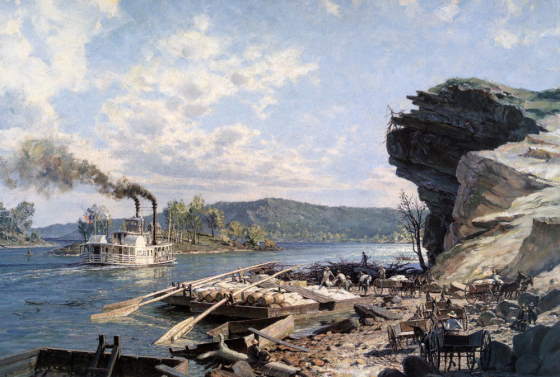
Ross Landing painting by John Stobart showing the steamboat and flatboats such as were used to transport the Drane and Deas-Whiteley groups to Oklahoma.